Recent searches
Search options

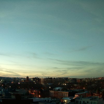
#dcwx
18 posts11 participants4 posts today


From WTOPNews.com: Full Weather Report
Last updated on April 30, 2025 at 5:07 a.m.
Jordan Evans, 7News First Alert Meteorologist
WEDNESDAY:
Morning clouds to sun
Highs: 80-85
Winds: North 5-10 mph
It will be a milder and muggier start to the day with morning temperatures in the 60s followed by afternoon highs in the low 80s. A northerly wind direction will help humidity levels fall a bit during the day with morning clouds giving way to a bit more sun midday.
WEDNESDAY NIGHT:
Partly cloudy
Lows: 55-63
Winds: Light and variable
Clouds will slowly return ahead of a weather-maker that will be on approach Thursday with isolated storm chances.

WTOP NewsWashington, DC WeatherSee the current weather conditions, hourly forecast, radar and 10-day forecast for the Washington, D.C. region.
GIF
GIF
GIF
GIF
GIF
GIF
GIF
GIF
LWX continues Marine Warning [wind: >34 KTS, hail: 0.00 IN] for Chesapeake Bay from Pooles Island to Sandy Point MD, Chesapeake Bay from Sandy Point to North Beach MD, Chesapeake Bay north of Pooles Island MD, Chester River to Queenstown MD, Eastern Bay, Patapsco River including Baltimore Harbor [AN] till Apr 26, 7:30 PM EDT
https://mesonet.agron.iastate.edu/vtec/f/2025-O-CON-KLWX-MA-W-0039_2025-04-26T22:08Z
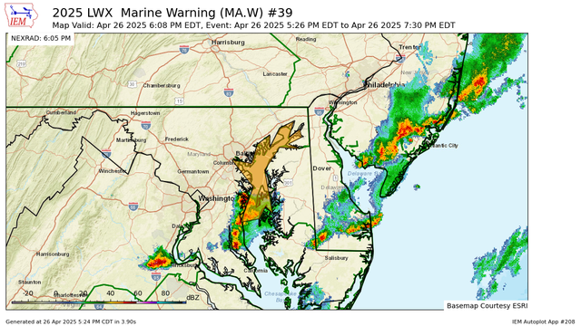
Iowa Environmental MesonetKLWX Marine Warning #39Chesapeake Bay north of Pooles Island MD, Chesapeake Bay from Pooles Island to Sandy Point MD, Chesapeake Bay from Sandy Point to North Beach MD, Patapsco River including Baltimore Harbor, Chester River to Queenstown MD, Eastern Bay
GIF
GIF
GIF
Parcialmente a mayormente soleado de nuevo mañana con máximas de alrededor de 80; más nubosidad el sábado, pero mayormente seco durante las horas de la mañana y a primera hora de la tarde, luego una pequeña posibilidad de algunas tormentas aisladas más tarde en el día/temprano en la noche. #RVA #VAwx #MDwx #DCwx
GIF
GIF
GIF
GIF
GIF